
The London Tube map is set to get a revamp as transport bosses will include the city's tram network on it for the first time.
The inclusion of the South London lines, which have been running since 2000, when they were originally known as the 'Croydon Tramlink, will be on a version of the map to be released officially next week.
Their inclusion, noted by Londonlist, will mean that only 238 of the 440 stations featured on Transport for London's (TFL) Underground map are actually tube stations.
Click to enlarge map
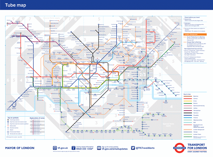
Tram services stretch from Wimbledon in the west to three East London branches, terminating at New Addington, Elmers End and Beckenham Junciton.
They will be denoted by a green bordered line, similar to the orange bordered line TfL use to display the London Overground network.

TfL have explained the tram network's addition is "designed to make it easier for those travelling to Wimbledon, Croydon or Beckenham to plan their journeys".

Other changes featured on the map include an update of stations with step-free access and where major upgrade works are planned to take part on the Overground.
The new Elizabeth Line, London's latest subterranean commuter route, will be added to the map when it is eventually opened in December 2018.
Extensions to the Northern and Metropolitan line changes will also feature from 2020.