Who doesn't like to talk about the weather? It's a great British obsession; a conversation starter and favourite topic of small talk! For me, the weather is so much more than that. It was a fascination as a young boy that has directed my whole education and career to become a self-confessed weather geek talking about it on a daily basis on BBC Radio 5 live.
I'm sure there are many times you can recall when the weather has been particularly notable? There are a few events that stick in my mind; the great October storm of 1987 which probably planted the seed in my head to become a weatherman, the 2003 European Heatwave when the UK reached its highest recorded temperature (38.5°C if you were wondering) and Hurricane Katrina in 2005.
Yes, it was 10 years ago this August when Hurricane Katrina slammed into the United States. Katrina was one of the strongest hurricanes ever recorded in the Gulf of Mexico and brought a huge storm surge along the coast of Louisiana and Mississippi. Nearly 2,000 people died, 300,000 homes were destroyed, an area of land similar to the size of the UK was damaged and it cost the U.S an estimated $125-150billion (the most costly hurricane ever to hit the U.S).
As the anniversary approaches there is no doubt we'll hear stories from New Orleans where we watched the news pictures of widespread flooding, people being rescued from their houses, being evacuated into the Louisiana Superdome and how they've rebuilt their lives over the past decade. However, I wanted to find what has happened to the science and technology in hurricane forecasting and find out if the US is prepared for another hurricane on the scale of Katrina. For a special BBC Radio 5 live programme, I headed Miami to investigate further.
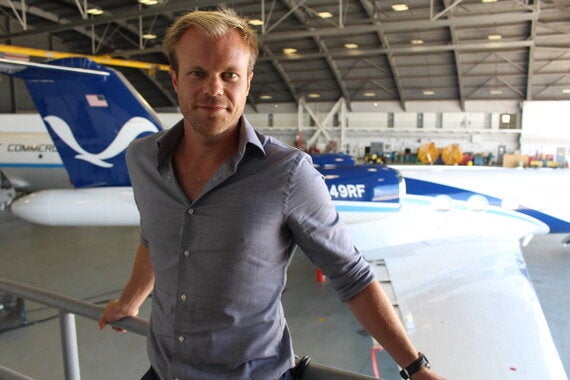
Why Miami? Not only is Florida hit by more hurricanes than anywhere else in the US but it is also the home to the National Hurricane Centre, the international hurricane research centre and the Hurricane Hunters; a US military unit who fly into hurricanes! I went to Miami to work, yes, but for me professionally and personally, this was my idea of a perfect holiday.
On the first day sitting in the Florida heat and humidity by his pool, I met Max Mayfield who was the director of the National Hurricane Centre during the time Katrina hit. While his role was to oversee the whole forecast operation, he acted as advisor to higher level government and emergency officials giving briefings all the way up to the President of the United States. As Katrina was lurking in the Gulf of Mexico as a monster category five hurricane on a collision course to the Gulf coast he recalls how he personally phoned the mayor of New Orleans to emphasise the seriousness of the situation they would be faced with once Katrina made landfall.
So, what has happened in hurricane forecasting since Katrina? The single biggest improvement has been in the weather computer models used to predict the path of hurricanes and the associated hazards such as wind strength, rainfall amounts and storm surge.
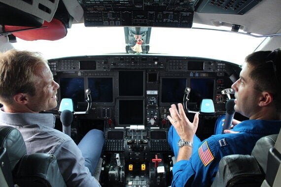
The improved computer modelling has come about from continuing reconnaissance and research conducted on planes flying into hurricanes piloted by the Hurricane Hunters. For me, this was the highlight of the trip! The Hurricane Hunters are the fifth and smallest arm of the U.S military comprising of NOAA (National Oceanographic Atmospheric Administration) pilots, meteorologists and support staff. At first I had the same reaction as you probably did - are they crazy?! You might think that after hearing veteran hurricane hunter Dr Hugh Willoughby describe the moment his plane lost an engine while in the eye of a hurricane. But as meteorologist, Jack Parrish who has flown through 525 hurricanes since he started in 1980 explained to me, it is a relatively safe thing to do.

While the science for forecasting hurricanes has improved resulting in five day forecasts rather than a three day forecast in 2005, the way we build and prepare for hurricanes has also improved. I went to see a facility at Florida International University called the 'Wall of Wind'. With twelve huge fans inside a hanger, scientists there are able to replicate a category five hurricane (winds >157mph) to test new building designs.
It's interesting to note that a major hurricane (classed as category three and above) hasn't made landfall in the U.S since the famous 2005 hurricane season and this is a concern to some who think people may not be as prepared as they should be. And does science tell us why we've been waiting so long? Not really. It's probably down to sheer luck so far.
As my whirlwind tour of the Florida hurricane-related venues ended, the re-occurring theme from my time talking to so many amazing people is that they are in the job to save lives and property. While some risk their own lives, others do a great job of researching, forecasting and communicating hazards. One comment will stay with me from my time in Miami... Had Max Mayfield not effectively emphasised the hazards of hurricane Katrina to the mayor of New Orleans who then evacuated the city, many more thousands of people would have lost their lives in August 2005.
Images copyright BBC
Hurricane Katrina 10 Years On: Science Of The Storm is an Audio Always production for BBC Radio 5 live and you can hear it on Sunday 30 August at 10am.