The UK is set to experience a wet and windy start to the new year, the Met Office has said as it issues two weather warnings for the start of the working week.
Forecasters have said that while many parts of the country will be enjoying a bright and cold-feeling day on Monday, low pressure systems could cause disruption to the first of the year’s commuter traffic.

(PA Graphics)
The Exeter-based service said extensive cloud and rain in the south will continue to slowly clear away eastwards on Sunday.
Meanwhile, some showers and more persistent rain and hill snow will affect Northern Ireland, southern Scotland and northern England at times.
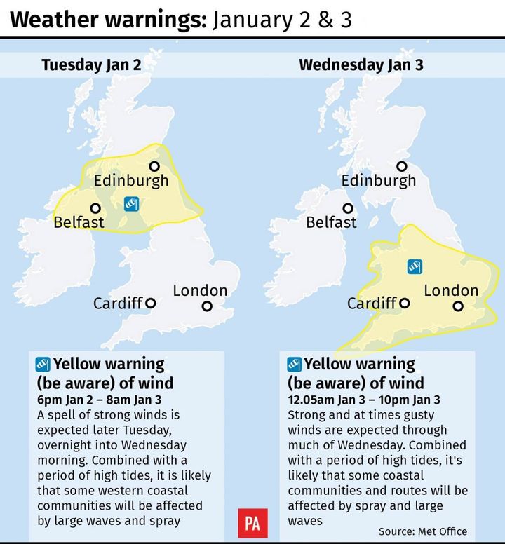
A yellow weather warning has been issued for between 6pm on Tuesday and 8am on Wednesday for north east and west England, northern Ireland and parts of Scotland.
The warning predicts gales with gusts of 60 to 70mph are likely, while some western coastal areas have a chance of seeing gusts of up to 80mph.
Andy Page, the Met Office’s chief forecaster, said: “The unsettled theme continues throughout this week, with further spells of rain moving across the UK from the west as many return to work on Tuesday and there will again be some snow over the high ground in Scotland.
“The wind will pick up again later on Tuesday and Wednesday is expected to be very windy across England and Wales, with gales or severe gales in places and national severe weather warnings have been issued for these strong winds.
“The gales, combined with locally thundery downpours, may make driving difficult and cause some disruption.”
A second yellow weather warning for high winds is in place from just after midnight to 10pm on Wednesday, covering the same areas as the previous day, plus the Midlands, the east of England, London, the south east and the South West and Wales.
The fresh warnings come just a day after Storm Dylan lashed parts of Ireland and Wales with howling gales in excess of 70mph and squally rain for a wet and windy New Year’s Eve.
Carol Holt, the Environment Agency’s flood duty manager, said the predicted strong winds and potential large waves, combined with high tides, could lead to some coastal flooding from Tuesday until Thursday.
The Met Office said the unsettled weather was likely to continue throughout the rest of the week, with further bouts of wet and windy weather interspersed with brighter, showery periods, expected.
Natural Resources Wales (NRW) said conditions around the coast were likely to be “very dangerous” over the next few days with an increased risk of flooding, particularly on the south east coastline around Monmouth and Newport, coastal areas in Swansea and Carmarthenshire and the entire North Wales coastline.