Storm Dylan is expected to cause disruption across the country as the weather front brings a wet and windy end to the year.
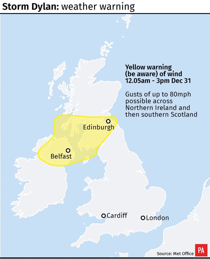
With gusts of up to 80mph expected in Northern Ireland and southern Scotland, forecasters warned there is the potential for “injuries and danger to life from flying debris”.
It comes as heavy snow, rain, thunderstorms and wind caused disruption across much of Britain on Friday as the country was gripped by another day of wintry weather.
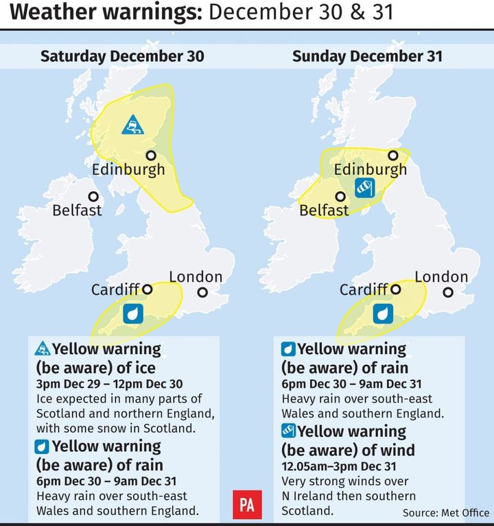
With the new year approaching, a yellow warning for wind has been issued for Northern Ireland and Scotland on Sunday, as Dylan begins to roll across the region.
The warning is in place from around 12am to 3pm, during which the Met Office said there is a “small chance of damage to buildings”, as well as power cuts and potentially issues with mobile phone coverage.
“Large waves and beach material being thrown on to coastal areas could also be a hazard,” the forecaster added.

(PA Graphics)
“There is a small chance of longer journey times or cancellations as road, rail, air and ferry services are affected, with the chance that some roads and bridges could close.”
Heavy downpours are also predicted to blight much of south-east Wales, plus south western, central and southern parts of England across the weekend.
With a yellow warning for heavy rain issued by the Met Office from 6pm on Saturday to 9am on Sunday, up to 25mm is predicted as likely to fall, while up to 40mm could be seen in some spots.

(PA Graphics)
“With the ground very wet in these areas, this is likely to lead to rising water levels and some flooding in places,” the Met Office said.
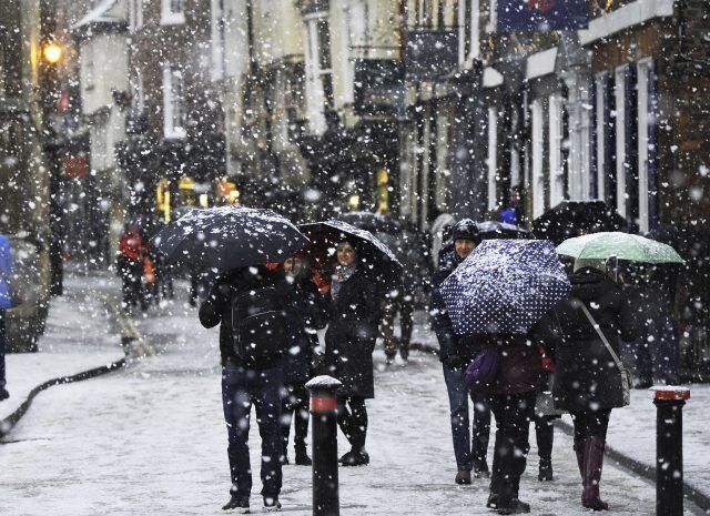
On Friday morning parts of northern England and Scotland were greeted by thick blankets of snow as the south coast was lashed by torrential downpours and lightning.
Homes were left without power, flights were suspended because of the snow and damage was caused to buildings by strong winds.
Downpours saw roads swamped with water and trees were felled due to the wind as the weather system made its way eastwards.
Glasgow saw the biggest snowfall in the UK, with more than 10cm recorded in Bishopton – forcing the city’s airport, one of Scotland’s busiest, to temporarily suspend flights.
In other areas 7cm fell at Redesdale Camp in Northumberland, 4cm in Bingley, West Yorkshire, and 4cm in Spadeadam, Cumbria.
In Hampshire a property in East Boldre suffered a large amount of tornado-style damage, with dramatic images showing most of the bricks from its roof blown out and scattered below.

People walk through the snow in York ( John Giles/PA)
The Met Office said at around 8.30am in Southampton, just 14 miles from the detached property, a gust of wind measuring 70mph was recorded.
Grahame Madge, a spokesman for the forecaster, said: “With thunderstorms and those sorts of systems you get rapidly rising and falling air.
“So it could have been convection that caused the problem (and damage to the house), rather than it being a typical tornado.”
He said a tornado cannot be ruled out, but this phenomenon is usually associated with much warmer weather during the summer.

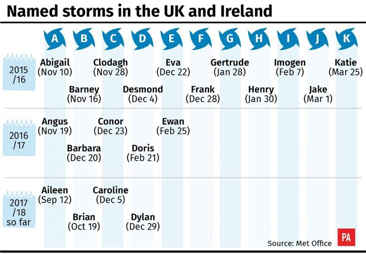
(PA Graphics)
The AA said it had received 13,284 calls by Friday at 6pm to its breakdown hotline, mostly from people in the north of England, particularly around Cumbria, south of Manchester and the Peak District, who were struggling with the snow or ice.
It dealt with 16,000 calls on Thursday and 19,000 on Wednesday making it “an incredibly busy three days,” AA president Edmund King said.
He added: “Our patrol force has been out in record numbers.
“Hopefully the weather will now let up slightly in terms of temperature although there is still a major concern due to the amount of standing water on many roads and more rain and wind on the way. It looks like being a wet and windy end of the year on the roads.”