Just as we were feeling safely locked in for sunny spring days, the Met Office has issued weather warnings across the UK for western parts of the UK and Ireland. Yay.
In typically chaotic British fashion, we can expect what the Met Office aptly described as a “smorgasbord” of weather types with rain, transient snow, unseasonably strong winds and, uh, temperatures above 20°C all featuring for some parts of the UK.
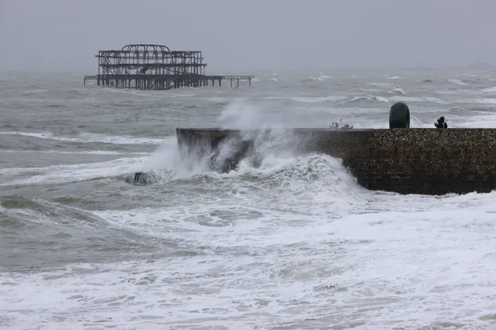
The Met Office has issued three yellow weather warnings over the next two days and Met Éireann has named an area of low-pressure Storm Kathleen, which will bring wind and rain impacts on Saturday.
Storm Kathleen wind warnings
According to the Met Office: “On Saturday a deep area of low pressure – now named as Storm Kathleen and the 11th named storm of this storm season - will move towards the UK and Ireland from the southwest bringing unseasonably strong winds to Ireland and western parts of the UK.”
A yellow weather warning is in place from 8am-10pm tomorrow for most western Britain and Northern Ireland.
Deputy Chief Meteorologist Christoph Almond said: “Gusts of 50 mph are expected quite widely on Saturday, while some exposed spots, particularly on the coast, will see 60 to 70 mph gusts with large waves also likely.”
Warm weather is expected, too
Despite this weather giving extremely ‘winter’ vibes, parts of the UK will see temperatures above 20°C for the first time this year. The Met Office said: “The locations likely to see the highest temperatures will be in parts of East Anglia and Southeast England where 21°C or 22°C is not out of the question briefly on Saturday.”
Next week, the weather is set to settle with southern parts of the UK expected to have warmer temperatures than average but northern parts of the UK can still expect, yes, even more rain.
Wild.