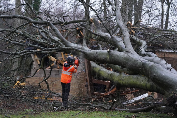
Storm Jocelyn is hurtling towards the UK this week, hot on the heels of Storm Isha – but the Met Office say it won’t be quite as intense.
Isha caused two deaths over the weekend, triggered power cuts and travel disruption across the country.
But, why have meteorologists warned that Jocelyn may actually have more of an impact on the country than its predecessor?
Why may Jocelyn have a greater impact than Isha?
It is set to be milder, but many places, and networks, are still recovering from the impacts of Isha which hit only on Sunday.
As Met Office chief meteorologist Steve Willington said: “Although this system will be a step down relative to Storm Isha, with the damage and clean up still underway, we could potentially see more impacts from Storm Jocelyn.”
Sky’s David Blevins also explained that “we are supposed to be in the lull between storms” – but the weather is already turning in Northern Ireland as Jocelyn looms.
He added that the proximity of the two storms is a “real concern” for those still working on the fallout from Isha, especially for those still struggling with blackouts.
Blevins also noted that it was 2016 the last time the UK got to the letter J with its alphabetically named winter storms.
What can we expect from Jocelyn?
The tenth named storm the UK has seen since September, Jocelyn is heading towards the country on a large-scale low-pressure system from the Atlantic.
The wet and windy weather will carry on throughout Tuesday night and into Wednesday for the north of the UK.
National severe weather warnings for wind – both amber and yellow – have been issued across the UK, as gusts could reach up to 65mph in northwestern Scotland, and possibly 80mph in a few areas.
The Met Office has also issued yellow rain warnings for rain in parts of Scotland and northwest England.
Around 15 to 20mm could fall across the country, with up to 50mm falling in the higher grounds in southwest Scotland, the Scottish Highlands and parts of northwest England.
Flooding is another risk, particularly across Cumbria, parts of North Yorkshire and the City of York. Any extra rainfall from Jocelyn is building on that which came from Isha and has not yet evaporated.
Martin Thomson, National Operations Manager for Resilience at Transport Scotland, noted that some roads and bridges are still disrupted from Isha, too.
However, he added “preparations are already underway” across the transport industry to “ensure we are as ready as we can be”.
The public are being urged to check with their public transport operators and local authority before travelling to get the latest information.
Luckily, the weather should ease off from Wednesday, according to the Met Office, although it will remain changeable.
But, temperatures will remain around the average for this time of year – a nice change from the Arctic blast we had earlier this month.
