
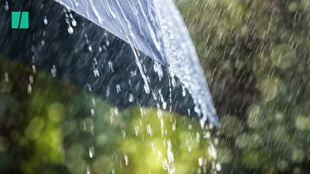
Two sinkholes forced the closure of parts of the M25 in both directions overnight, with further disruption expected as torrential rain continues to lash the country.
On Monday night, police were forced to shut a section of the M25 overnight after discovering two sinkholes on the central reservation.
Kent Police’s Roads Policing Unit tweeted there had been a road traffic accident involving one vehicle between junctions four and five, near Sevenoaks.
This in turn lead to the discovery of two sinkholes in the central reservation, the unit said in the tweet.
The motorway was closed in both directions and Highways England said it was assessing the “serious road defect” and the M25 would remain closed on Tuesday morning.
One of those affected by the closure and subsequent diversions was children’s television presenter Dave Benson Phillips.
The Get Your Own Back presenter had been directed off the M25 in Kent onto a flooded road and said he had driven in waist deep water.
He subsequently spent some time warning other drivers about the flooded road.
His tweet said: “If you were directed off the south part of the M25 to a flooded road on the way into Kent, and there was a black bloke in a Toyota warning all drivers the road was flooded, I hope I helped.”
Meanwhile, Kent was hit with further disruption when heavy flooding closed all lines through Orpington railway station for several hours.
National Rail has also warned that Southern and Thameslink trains will be heavily impacted during the morning commute, with some services delayed or cancelled due to flooding.
North-eastern parts of England and the Midlands are expected to bear the brunt of the downpours on Tuesday, with a yellow warning in place until midnight.
Some areas set to see up to 60mm of rain, particularly over the first half of the day, according to the Met Office.
Another warning covers Devon and Somerset, where similar conditions are expected.
On Monday, forecaster Steven Keates said some places could see a month’s worth of rain in just two days.
The Environment Agency has issued three flood warnings in south-east England, for the River Wandle at Morden, south London, the Emm Brook at Wokingham and Ravensbourne at Bromley.
The agency said on its website: “River levels have risen as a result of localised thunderstorms. Flooding of property is expected imminently. Please take action.”
A total of 31 flood alerts – which mean flooding is possible – are in place across the country.
On Wednesday and Thursday, some parts of the UK could be struck by 60mm to 80mm of rain, and possibly even up to 100mm.
Met Office meteorologist Alex Burkill described the figures as the “worst-case scenarios” but added that people need “to be aware that we’re in for some treacherous weather”.
“If you add it all up some places are likely to see over 100mm this week, which is around double the average they would get in the whole of June,” he said.
Residents are being told to avoid low-lying footpaths near local watercourses and plan driving routes to avoid low-lying roads near rivers which may be flooded.